

If you’re blind, maps aren’t much use. Tasks that are easy for most people — studying a foreign country or even finding the route from your dorm to class — are complicated. A group of undergrads is working to change that.
In Spring 2002, they developed software that allowed Jason Morris, a classics graduate student who is blind, to navigate a map of the British Isles by using an ordinary computer with a touchpad. When Morris drags the mouse over water, he hears the sound of waves. When he touches land, horses’ hooves thunder. As he moves over one of the 393 cities, a computerized voice speaks and spells the name. The computerized map also gives him information about city elevations and distances between cities.
Morris was able to write a paper based on his exploration of that map. And the undergrads fulfilled their requirements for a software engineering class. But when the semester was over, they weren’t satisfied. Neither was Gary Bishop, the computer science professor who had introduced them to Morris. If, in one semester, they could make a single map available to Morris, what could they do if they worked longer? They wanted to continue work on the software, which they named BATS — Blind Audio Tactile Mapping System.
Bishop and Tom Elliott, director of the Ancient World Mapping Center, went on a funding hunt. In July 2002, Microsoft Corporation gave the project an unrestricted gift (money with no strings attached). Other companies such as Kensington and Intel have donated equipment. Some of the original students and a few new ones are working to add new feedback options. For instance, BATS will now give information by vibration as well as by sound.
The team is also working on programming that will let users tailor BATS to their needs. Sighted users, for instance, could turn off the audio. Or users with limited sight could increase the contrast of images on the screen.
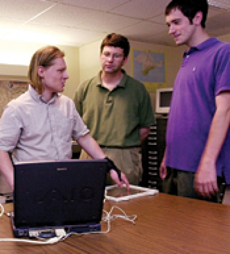
The team is doing demos for various groups — high school students, Carolina’s Office of Disabilities Services — to find out what users need. “The real goal for me is making something work for Jason. And let’s find some high school students and make something work for them,” Bishop says.
It may be years before BATS is ready for the public. The hardest task will be making BATS work easily with many different types of maps. It took a semester of programming to make BATS work with the British Isles map. For the program to be widely useful, inputting content will have to be much easier than that. But the team is excited about the possibilities. They’re experimenting with a map of North Carolina, and students at Broughton High School in Raleigh are working on making a map of their high school accessible by BATS.
Bishop wants to eventually offer BATS as free software. Users could then create map content or buy it from independent publishers. Because the market is so small, assistive devices for the visually impaired are often too expensive for the average user. “You and I have gotten accustomed to [buying] amazing devices for fifty dollars,” Bishop says. But a program that reads a computer screen to the user, for instance, costs about $1,200.
And with textbooks, content isn’t expensive — it doesn’t exist. “There are visually impaired kids in forty-five schools in North Carolina,” Bishop says. “When these school systems buy books [they ask] ‘what have you got for the visually impaired kids?’ The answer is, nothing.”
“I haven’t seen anybody doing shareware or freeware for disabled people,” he says. “If the universities can’t do it, who can?”
The BATS web site includes a video documentary of the BATS project and information about demo software. Students currently involved in the project are undergrads Kathleen Delker, Jennifer Davis, Charles McGaw, Shawn Hunter, and Elan Dassani, and graduate student Peter Parente. Other sponsors are MapQuest, Immersion, SourceForge.net, and Carolina’s Ancient World Mapping Center.